


The 8 Sections of the Jordan Trail: What Each One Actually Delivers


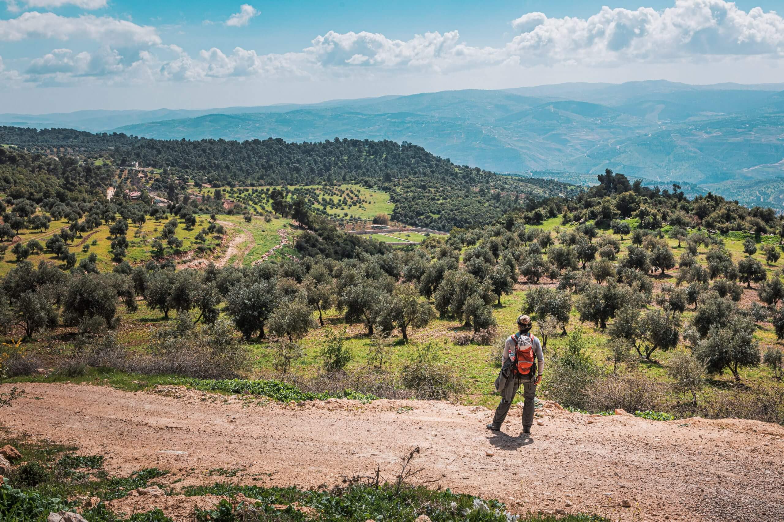
Stretching 675 kilometers from Um Qais in the north to Aqaba on the Red Sea, the Jordan Trail isn't just one long hike—it's eight distinct experiences stitched together. Established in 2015 by the Jordan Trail Association, the route crosses 75 villages and takes roughly 40 days to complete in full. But here's what most guides don't tell you: each section feels like hiking in a different country.
Most travelers tackle one or two sections rather than the full trail. That's smart—you can spend limited vacation days on the segments that match your fitness level and interests. Here's what each section actually delivers, from the green forests of the north to the empty desert stretches of the south.
Section 1: Um Qais to Ajloun
Distance: 80 km | Days: 4 | Difficulty: Moderate
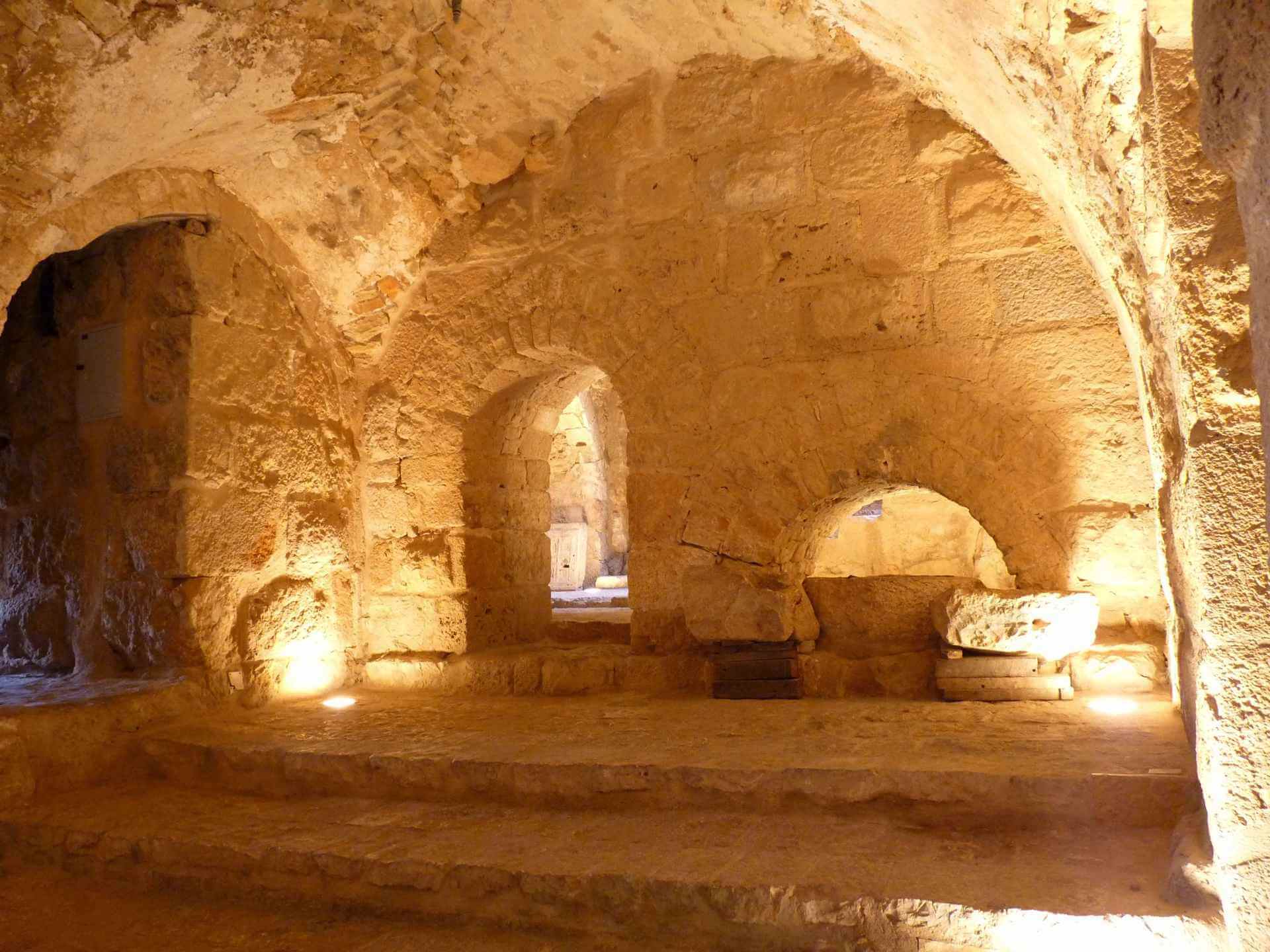
The trail starts in Jordan's greenest region, which surprises hikers expecting endless desert. You'll walk through oak forests, olive groves, and valleys dotted with ancient Greco-Roman ruins including Gadara, with views stretching to the Sea of Galilee on clear days. The 12th-century Ajloun Castle marks the finish line—a Crusader-era fortress built in 1184 to defend against invaders.
What hikers actually do here: Navigate unmarked trails through fertile highlands, pass hot springs and Byzantine-era structures, and stay in family-run homestays where dinner and breakfast are included. The 2024 official thru-hike covered this section from October 11-15, with daily distances ranging from 14-18 km. Spring transforms the landscape into fields of red poppies and Jordan's endemic black iris.
Section 2: Ajloun to As-Salt
Distance: 62-75 km | Days: 4 | Difficulty: Moderate
This section drops past the vast King Talal Dam before climbing back into farmland and small villages. The highlight is Rmemeen, where a mosque and church sit side by side in the town center—a physical representation of Jordan's religious coexistence. The section ends in As-Salt, designated by UNESCO in 2021 as a "city of tolerance and urban hospitality" for its Ottoman-era architecture.
What hikers actually do here: Follow quiet country tracks with wild camping opportunities overlooking the dam, pass through the village of Fuheis (home to Jordan's first microbrewery, Carakale), and experience the transition from northern greenery to the drier landscapes approaching the Dead Sea region. Daily distances range from 15-20 km.
Section 3: As-Salt to Wadi Zarqa Ma'in
Distance: 70-80 km | Days: 4-5 | Difficulty: Moderate to Difficult
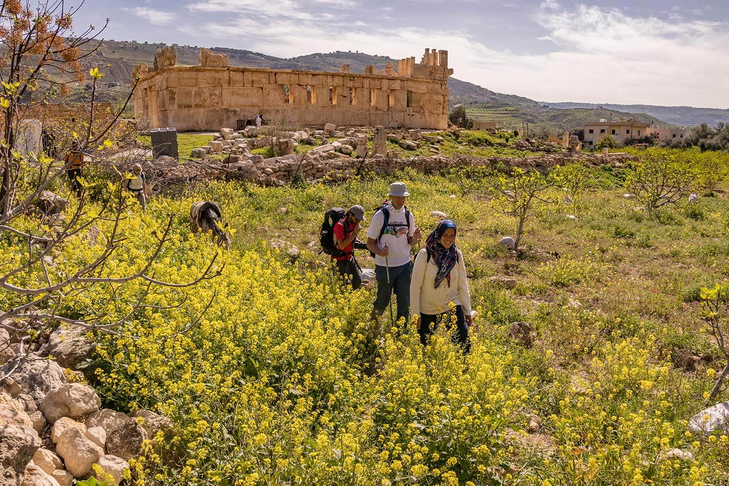
The landscape shifts dramatically as you descend toward the Dead Sea basin, the lowest point on Earth at 430 meters below sea level. This section follows the historic King Hussein's Rally Road, built to satisfy the former ruler's passion for cars. You'll pass the 2,000-year-old Qasr al-Abd palace in Iraq Al-Ameer before reaching the hot springs of Wadi Zarqa Ma'in.
What hikers actually do here: Hike through increasingly arid terrain with sporadic Bedouin camps, carry extra water as villages become sparser, and potentially end the section with a soak in natural hot springs. This is where many hikers first experience sleeping in Bedouin camps under desert skies. The elevation changes are significant—you're climbing and descending constantly.
Section 4: Wadi Zarqa Ma'in to Karak
Distance: 46-47 miles | Days: 4 | Difficulty: Difficult
This is objectively the hardest section of the northern trail. You'll cross three deep wadis—Hidan, Mujib, and el Tawahin—with the 2,600-foot-deep Wadi Mujib often called the Grand Canyon of Jordan. Expect up-down-up-down terrain across lunar-like landscapes. The section concludes at Karak's imposing 12th-century Crusader castle overlooking the surrounding plains.
What hikers actually do here: Navigate steep ascents and descents (up to 1,000+ meters in a single day), cool off in Wadi Mujib's fast-flowing stream, and wild camp beneath exceptionally dark skies perfect for stargazing. This section demands solid fitness—it's 47 miles of relentless terrain with archaeological sites like the elegant stone arches of Majdaline ruins scattered along the route.
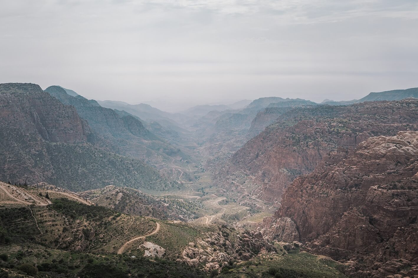
Section 5: Karak to Dana
Distance: 83-88 km | Days: 4-5 | Difficulty: Difficult
The Crusader-era landscape continues as you depart Karak, passing abandoned villages and old fortifications. After crossing orchards and fertile plains, you'll tackle another Dead Sea canyon—Wadi Hasa—where towering limestone cliffs and ridges dominate. The section ends at Dana Village, perched on the rim of Jordan's largest nature reserve, the Dana Biosphere Reserve.
What hikers actually do here: Descend dramatically into Wadi Hasa (dropping over 900 meters), climb back up the other side past Bedouin encampments, and visit ancient Edomite ruins at Sela and Ma'tan dating to the Bronze Age. Daily distances range from 14-23 km, with the longer days requiring 6-8 hours. The 2024 organized trek allocated 5 days plus a break day for this section.
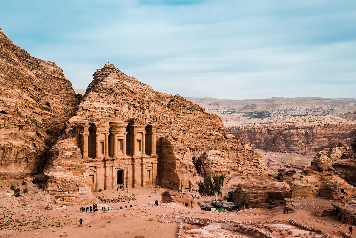
Section 6: Dana to Petra
Distance: 80-84 km | Days: 4-5 | Difficulty: Moderate
This is the trail's crown jewel. National Geographic named it one of the 15 best hikes in the world, and it's easy to see why. The route descends from Dana Village through the biodiversity-rich Dana Biosphere Reserve, crosses multiple climate zones, and concludes with the "back door" entrance to Petra—avoiding the tourist crowds at the Treasury.
What hikers actually do here: Hike through Wadi Feynan's copper mining landscape, stay at the acclaimed Feynan Ecolodge (named by National Geographic as one of the world's best), traverse the dramatic Sharah Mountains where shepherd paths cling to cliff edges, and enter Petra slowly from the rear, experiencing the ancient city as traders once did. Organized tours for this section typically cost 450-520 JOD and include wilderness camps with Bedouin support teams. September 2024 hikers reported temperatures reaching 30°C during the day but manageable with frequent shade breaks.
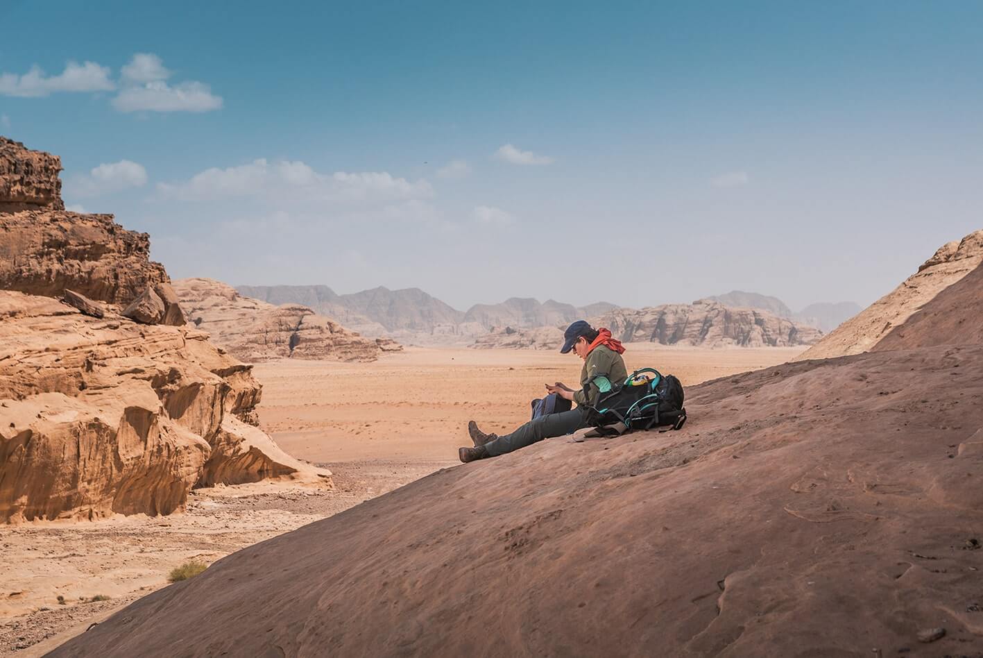
Section 7: Petra to Wadi Rum
Distance: 90.6 km | Days: 5 | Difficulty: Moderate to Difficult
This is the longest wilderness stretch on the entire trail. You'll cross empty high-elevation desert between two UNESCO World Heritage Sites, passing through wadis that cut deep into sandstone rock. The isolation is genuine—food might be available at Bedouin camps, but water sources are sporadic and you'll need to plan carefully.
What hikers actually do here: Start near Petra's Bdoul village and descend through impressive sandstone mountains and dry valleys, pass the "colored canyon" rich in rainbow-hued mineral deposits, navigate the curvaceous walls of Wadi Aheimar, and reach the Nabatean trading post ruins at Humeima before entering Wadi Rum's otherworldly landscape. Daily distances range from 14-24 km. Wild camping is the norm—expect wilderness camps where Bedouin support teams set up everything before you arrive.

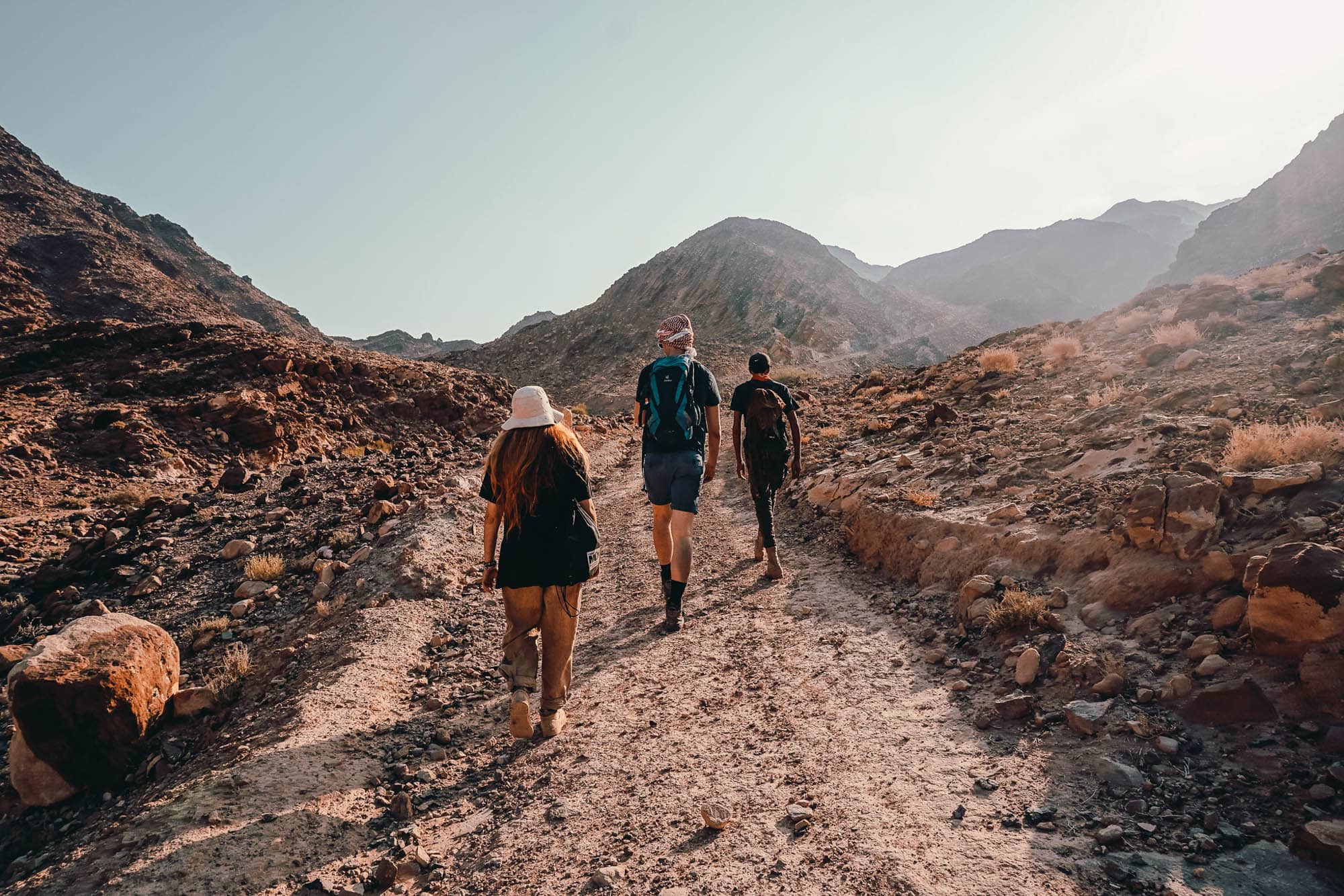
Section 8: Wadi Rum to Aqaba (Red Sea)
Distance: 67-75 km | Days: 5-6 | Difficulty: Moderate
The trail's final section follows the route Lawrence of Arabia took when he attacked Aqaba in 1917. You'll hike beneath the towering cliffs of Jebel Rum and Jebel Um Ishrin, pass ancient rock art at Jebel Khazali, and descend through long sandy wadis as the first glimpse of the Red Sea appears on the horizon.
What hikers actually do here: Navigate granite mountains and desert valleys on old shepherd paths, visit the "dripping spring" hidden among Wadi Rum's colorful sandstone formations, and finish the trail where the desert meets the turquoise waters of the Red Sea at Aqaba. This is your reward—dive shops, coral reefs, and the knowledge that you've crossed an entire country on foot.
The Reality Check
The Jordan Trail isn't like Europe's well-marked paths or America's maintained long-distance routes. It's largely unmarked—GPS files from the official website are mandatory. Water is scarce in desert sections, requiring organized water drops. And flash floods can close sections during winter (December-February).
Most hikers join organized groups or hire guides. The Jordan Trail Association runs annual thru-hikes each October-November, with 2024's event covering 675 kilometers from October 11-November 23. Expect to pay 450-520 JOD per 5-day section for organized trips that include guides, water, meals, and camping equipment.
Spring (March-May) and autumn (September-November) offer the best hiking conditions—summer temperatures can hit 40°C in the desert, making southern sections dangerous.